Schools
- Perth Avenue Junior Public School
- Indian Road Crescent Junior Public School
- Lucy McCormick Senior School
- St. Luigi Elementary School
- Bishop Marrocco/Thomas Merton Secondary School
Commute Times
- To Downtown Toronto (Union Station)
- By Car: 23 Mins
- By Public Transit: 15 Mins
- To Midtown Toronto (Yonge & Bloor)
- By Car: 20 Mins
- By Public Transit: 23 Mins
- To Toronto Pearson Airport
- By Car: 26 Mins
- By Public Transit: 24 Mins
Boundaries
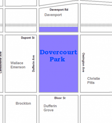
- This neighbourhood is in a triangle shape, with railway lines on each side.
- The CPR east-west line to the north
- The CNR line to the east
- The CNR/CPR mainline to the west
- Dupont Street passes through the northern part of the neighbourhood
- Lansdowne Avenue is nearby, on the east side
- Bloor Street passes through the southern part of the neighbourhood
- Roncesvalles Avenue is nearby on the west side


